6 unusual Canadian natural wonders, explained

Canada and its natural spaces are loaded with mystery. A simple hike in the Rockies, a drive through the Prairies, or a beach day in P.E.I. will bring out a traveller’s curiosity. Why does the landscape look the way it does? What makes the colours of the lakes, trees and dirt so vibrant? If there’s one thing that Canadians can definitely brag about, it’s the country’s breathtaking nature. And you may be a little curious as to how things appear as they do. Here, get ready to revisit the wisdom of your school science textbooks as we dive into six of Canada's craziest natural phenomena... with an explanation as to what creates their beauty.
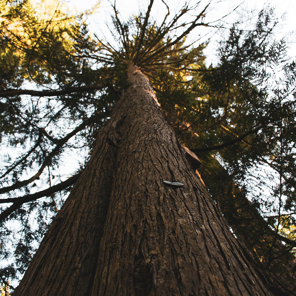
1. Why are West Coast trees so big?
Canada’s one and only rainforest lies along the entire Pacific coastal region of British Columbia. A solid strip of old-growth trees, these forests account for 25% of the world’s temperate rainforests. And, as anyone who visits will notice, many of these trees are absolutely massive. Like, huge. Why is that the case? As humid winds from warm ocean currents rise over the Pacific mountain ranges, they cool. This natural process provides the region with up to five meters of rainfall annually, making this a climate ideal for plants, fungi and trees to thrive. With all the lush greenery and overhanging canopies, trees have to compete for sunlight, so they keep growing. Thanks to few disturbances and natural disasters like wind storms, landslides, and wildfires, these trees can live a long time.
Stanley Park is one of the last remaining patches of coastal temperate rainforest in lower mainland B.C. There you can walk through the old-growth rainforest with trees more than 60 metres tall—with the oldest being 250 years old! Note that rainforests make up less than 10% of the earth’s surface and provide us with a third of the world’s oxygen. So go in there and thank the trees!
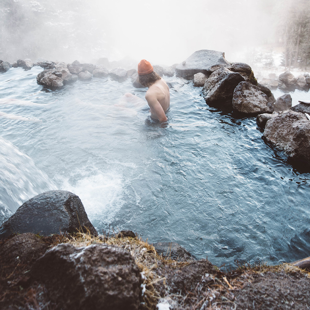
2. What makes hot springs hot?
When you’re travelling in British Columbia, Alberta, or the Yukon, you’re likely to hear about Canada’s natural hot springs. Hot springs exist when the right geological conditions are met. Melted snow, rainwater, and groundwater seep into the earth following cracks and fissures in a sort of natural plumbing system. Thanks to residual energy from the formation of the earth, our planet emits primordial heat and warms the water to nice, soothing temperatures. In western Canada, for each kilometre of depth into the earth, the temperature rises by 30 degrees. The second source of heat for these hot springs is the heat emitted from decaying radioactive elements such as uranium, thorium, and potassium. With added heat into this natural plumbing system, pressure builds, and water is bubbled back up to the surface where it can range from body temperature up to boiling hot! With high mineral content and bath-like temperatures, hot springs have always been used for healing, and once you’re in, you’ll know why.
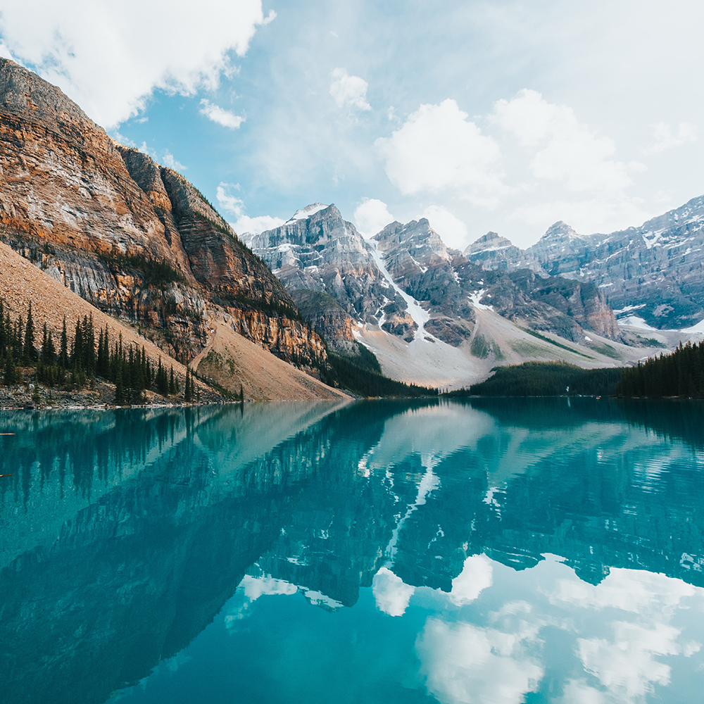
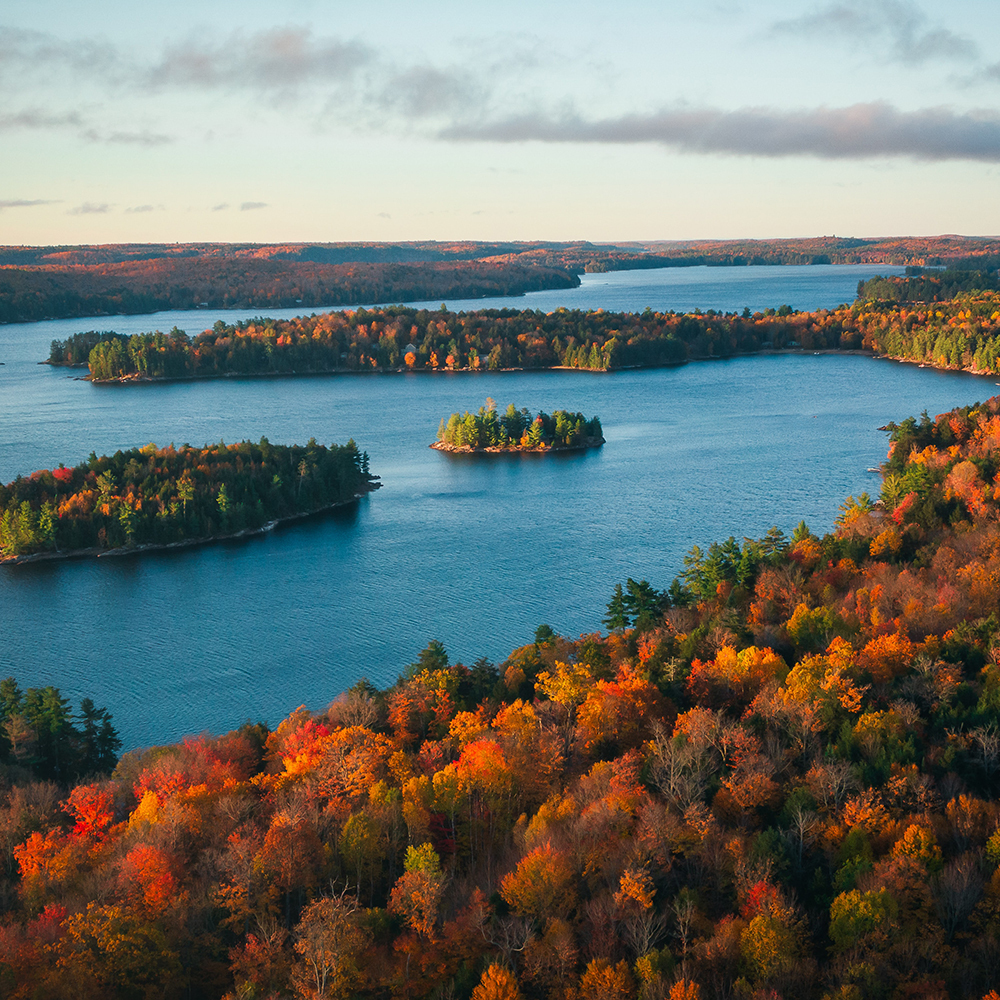
3. Why are glacial lakes turquoise?
It’s truly mind-blowing how glacial lakes can glow a bright blue, turquoise or emerald, but there’s a good reason behind it. These types of lakes are formed by glacial erosion, where glaciers cause the fracturing, crushing and movement of bedrock as they expand and contract during their cooling and melting cycles. Valleys and river beds are carved out of the bedrock leaving behind all sorts of construction debris from boulders to dust. Streams then collect and deposit sediment from the glacial erosion process into the lakes. Larger pieces of sediment sink to the bottom but finer particles, called rock flour, mix into the water forming a sort of glacial milk.
When hit with sunlight, this rock flour-rich water absorbs all short wavelengths of light, leaving a mix of green and blue light which combine to make a glowing turquoise! The finer the rock flour in the water column, the more it will shine a brilliant blue. Because of how light is reflected off these lakes, you get the best views with the brightest blues after hiking up to a higher viewpoint on clear sunny days.
4. How many lakes are there in Canada?
Canada is the country with the most lakes in the world! In fact, 891,163 square kilometres of Canada’s total area is fresh water. That’s nearly 9% of Canada. So… that’s why we’re so into dock lounging in summer, hiking to hidden-gem lakes, and exploring our country via crazy canoe trips. Hey, we’ve got a ton of lakes here and it’s the Canadian way!
But how many lakes actually exist in Canuck country? When it comes to counting the many lakes that cover the Canadian landscape, it’s not an easy feat. If we count only the lakes bigger than 100 square kilometres, it would total 563 lakes. But this excludes a massive amount of smaller lakes. In total, there are estimated to be two million lakes across Canada. Carefully scan over Canada under a satellite map view and you’ll notice how much of the land is little bodies of water. If you’re interested in really seeing more of Canada, then you’ll have to visit one of our wilderness locations or lake-side hostels. Truly visiting Canada wouldn’t be complete without a little time on a lake.
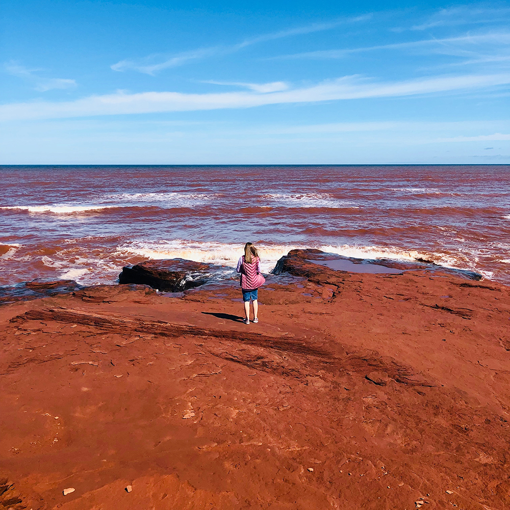
5. Why is the dirt red in P.E.I.?
Have you seen the beautiful pictures of the red coasts of Prince Edward Island? Or perhaps the mesmerizing green and red striped potato fields covering a majority of the landscape of this quaint and pretty province? The reason the dirt is red is simple. The soil and rock in P.E.I. is made up of clays, sandstone and mudstone, stemming from eons of natural weathering. The reason the soil is red is because it’s rich with iron oxides—the same molecule that gives rust its distinct appearance. The reddish colour is caused by the oxidation of the naturally occurring iron in the soil. Not only is it beautiful, but it’s also useful too! This red dirt also happens to make Prince Edward Island great for farming and agriculture since it drains well and is high in nutrients, iron and other metals. To check it out for yourself, book a visit! Our hostel in Charlottetown has just reopened in time for summer… *hint, hint.*
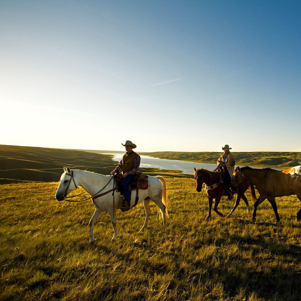
6. Why are the Prairies so flat?
The Prairies are indeed super flat (but fertile!) lands in the middle of Canada. They are made up of plains, grasslands and lowlands and are part of the Great Plains which stretch across North America, from the Gulf of Mexico up into Manitoba, Saskatchewan, and Alberta, between the Rockies and the Great Lakes. About 100 million years ago the Prairies used to be a massive (albeit shallow) inland sea. But as mountains rose in the west, the seabed rose, and the sea retreated. With a tilt like that coming from the west, rivers and sediments drained eastward further eroding the landscape. The mountains eventually created what’s called a rain shadow—this is when the mountains block the rainfall and in turn, create a dry, arid space where plants (like trees) are unable to grow tall. And with that, you get three provinces as flat as the pancakes you drench with pure Canadian maple syrup. Don’t overlook this lovely Canadian landscape, it’s much prettier than you might think. And if riding horses across plains into the sunset is your thing, check out our one-of-a-kind Manitoba hostel.