Seven hikes to explore Canada’s East Coast

My first Canadian winter after several years of living abroad left me craving adventure. My legs felt stiff from hibernating under a blanket on the couch with a book in hand, so my partner and I decided to drive from our home in Ontario to the East Coast of Canada this spring. We hiked in every province between Ontario and the ocean. Here are seven trails that stood out.
Quebec
1. Mont Rougemont, Michel Jodoin Cidrerie
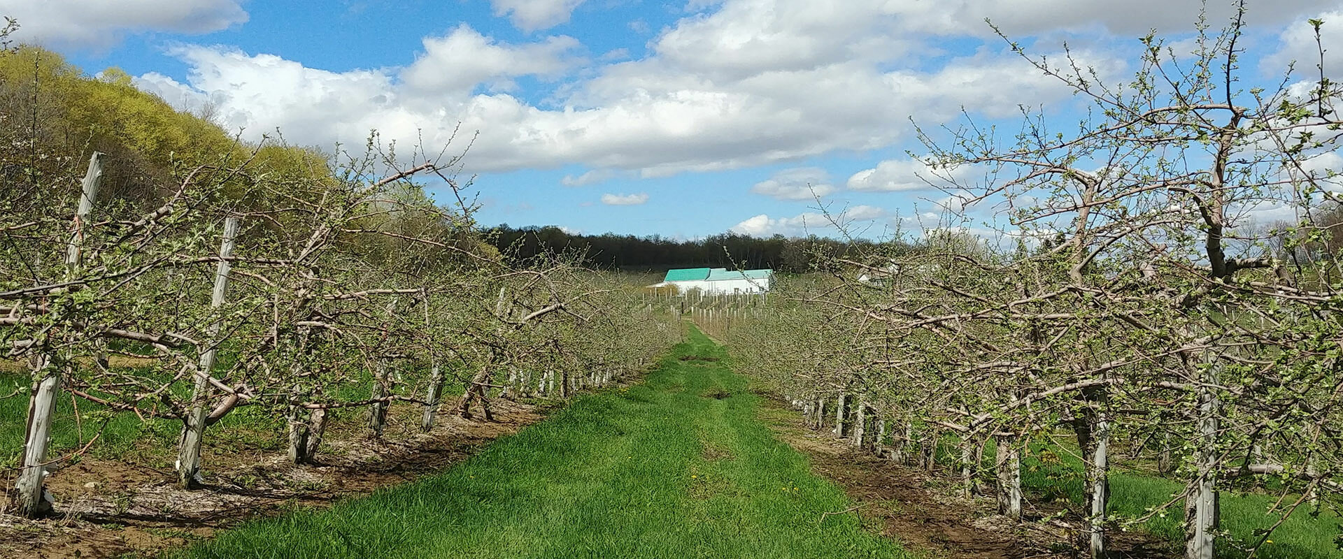
Just a few hours east of Ontario, we found ourselves amongst rolling orchards in Quebec and heading for Mont Rougemont, where I had read about a trail starting behind a ciderhouse. A woman at the cider shop greeted us in front of a wall of craft bottles. When I told her we were there for the hiking trail, she handed us a map and said with a smile, “You will try the cider when you get back.”
Heading up the mountain, we were surrounded by sounds of trickling water from a small creek and flowers pushing up through the forest floor. The trail was fairly easy after a steep incline at the beginning, and the lookout at the top had a breathtaking view of the farm fields and orchards below. After spending a few moments taking it all in, we headed back down towards the cider house and were welcomed with samples of delicious apple cider.
- Distance: 3.6 km loop
New Brunswick
2. Matthew’s Head, Fundy National Park
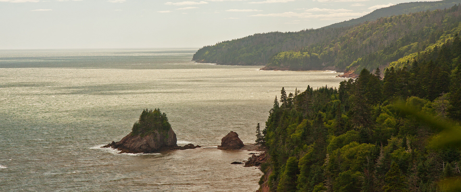
The landscape shifted from rolling farms to rugged coastline as we arrived in New Brunswick. In Fundy National Park we made our way to Matthew’s Head Trail, which led us through a hyper-green, mossy pine forest, the path an intricate tangle of roots. In several places, the trail opened up to reveal views of the red, rocky coastline, with waves slamming into the shore far below us on the Bay of Fundy.
- Distance: 4.5 km loop
- Where to stay? HI Wentworth
3. Hopewell Rocks
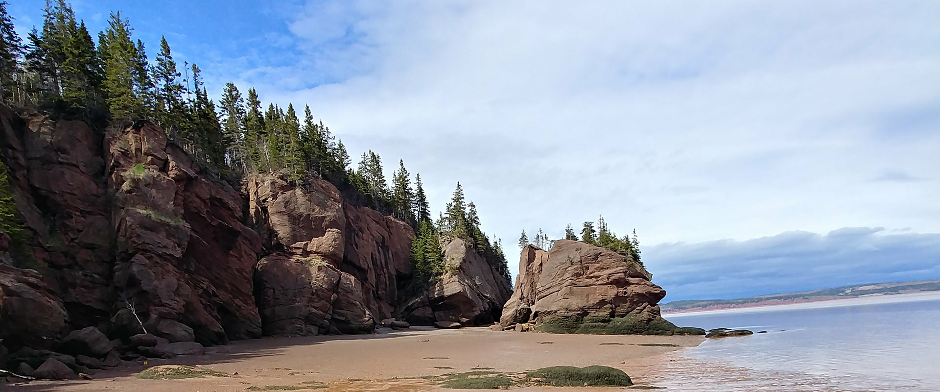
While in New Brunswick, we had to see the natural wonder of Hopewell Rocks, where the tide rises and falls about 14 metres twice a day, and walk on the ocean floor. We arrived at low tide and walked for 15 minutes from the visitor’s centre to the stairs leading down to the main beach. The ocean floor was red and muddy, the flowerpot formations unimaginable—tall islands balanced on rocky stilts. When we reached a rocky outcropping of boulders at the far end of the beach, we climbed up to get a higher view of the ocean. At that point, a park ranger approached us, telling us that while the park was closing, we could continue exploring, and that if we kept going, we would eventually reach Demoiselle Beach, where we could link up with a walking trail that would bring us back around to the main entrance.
We continued picking our way over slippery, seaweed-covered boulders, trying to avoid crushing the snails left behind when the tide had gone out. We reached Demoiselle beach with muddy hands and boots, and found the gravel trail heading back.
- Distance: ~ 4.6 km loop
- Where to stay? HI Wentworth
Prince Edward Island
4. Greenwich Dunes Trail
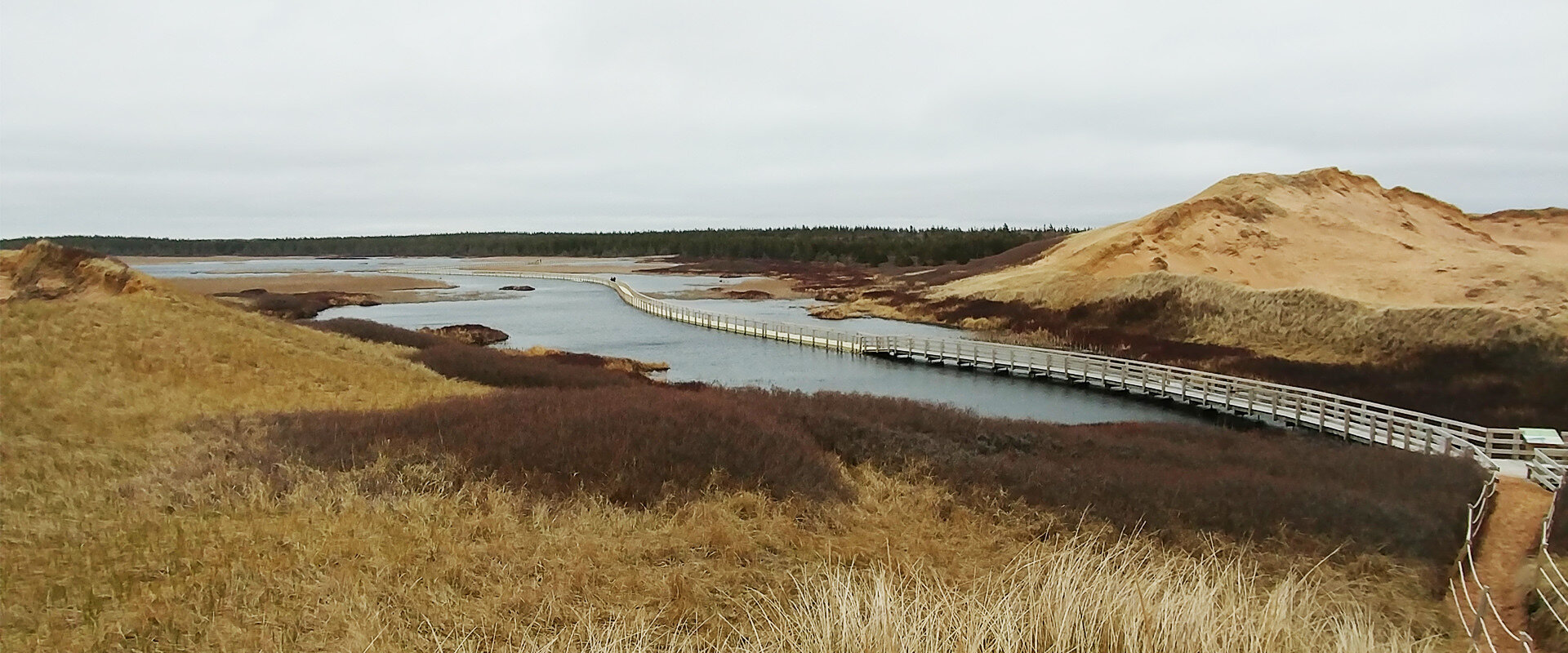
PEI is for beach walks and shell picking, which we did on the sunny but windy afternoon we left New Brunswick, taking Confederation Bridge to the island of red dirt. The Greenwich Dunes Trail on the north side of the island features a floating boardwalk over a pond with a fragile ecosystem constantly threatened by saltwater flooding. The low-difficulty trail carried us through old farmland, thick forest, over the pond and finally over sand dunes to the beach, where we walked up and down the shore as the waves crashed in, looking for treasures in the sand.
- Distance: 4.8 km out and back
- Where to stay? HI Charlottetown, Backpackers Inn
Nova Scotia
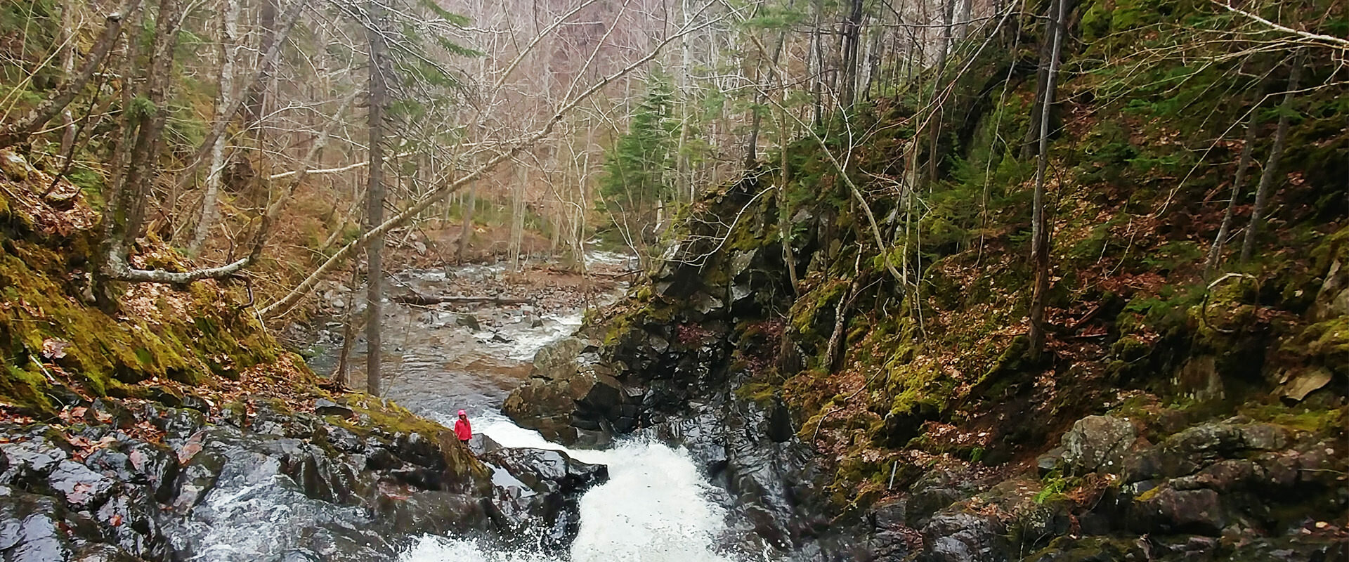
5. Macintosh Brook, Cape Breton
When we finally reached Cape Breton Island, we were enthralled by the views driving the Cabot Trail. As we continued north, we took a short walk through old growth hardwood forest to get to a waterfall hidden at the end. The trail meandered along a creek before reaching the roaring falls, which we rock-hopped up to get a view looking down. Although it was rainy, this short trail was a great way to stretch our legs as we drove towards the northern tip of the island.
- Distance: 1.7 km loop
6. Meat Cove, Cape Breton
Meat Cove was given its name is the 1700s when the stench of slaughtered moose caused complaints from ships passing by the cape on the ocean. Despite the off-putting stories, I was intrigued, and had read in a guidebook about a trail with a magnificent lookout. So, we took a detour from the Cabot Trail, following the only road going into or out of Meat Cove. It starts out paved, but soon becomes gravel, and eventually ends altogether at a cliff.
The first 30 metres of the trail was an intensely steep incline, and we needed to use our hands at some points. The rugged, rocky trail continued upwards into the forest where we saw lots of animal droppings, making us hyper vigilant, scanning the woods as we ascended. The lack of signage had us constantly questioning whether we were heading the right way, but finally we reached the summit where the trees opened to the most secluded, rugged natural beauty we had seen yet. Thick fog started rolling in, but we could make out the mountains, the forest, and the sea below. We enjoyed the view momentarily, but the eerie feeling of the remote woods soon had us turning around.
- Distance: 3.5 km out and back
- Elevation gain: 79 meters
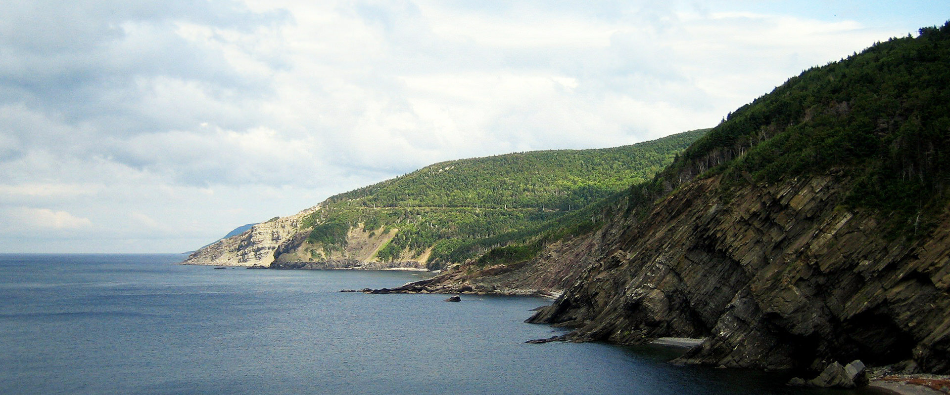
7. Skyline Trail, Cape Breton
The Skyline Trail is a great way to get some elevation for an almost bird’s-eye view of the mountains, ocean and winding cliff-side road. We chose to do the full loop, rather than the shorter out-and-back option. When we came out of the forest to the lookout platform, we could see boats on the ocean and tiny cars driving the Cabot Trail.
While there were quite a few people at the lookout, we were alone on the longer way back. The loop offered more views of dusky skies over the ocean, and as we quietly made our way through the trees back into the forest, we spotted a male and female moose, metres away from us, munching on trees just off the path.
- Distance: 8.2 km loop

